Drones equipped with sensors capture data from above, creating detailed maps and models of the ground for various applications like agriculture, construction, and disaster response
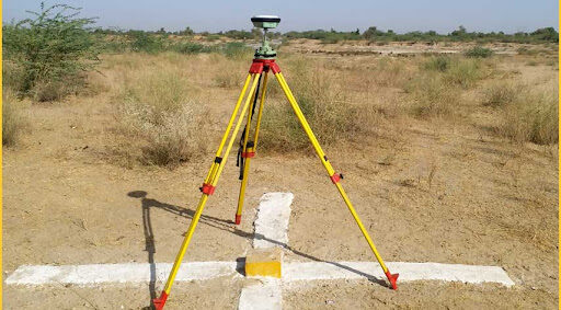
DGPS SURVEYING
Prior to the aerial survey, a Differential Global Positioning System (DGPS) can be used to map the boundary of your site. DGPS is an enhancement to the Global Positioning System (GPS) which provides improved location accuracy. It uses a combination of receivers and satellites to reduce/eliminate common receiver based and satellite based errors. This helps you create a highly accurate KML (KMZ) file of your site.
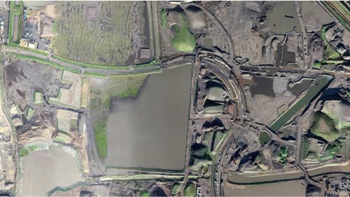
ORTHOMOSAIC MAPS
Drone images are corrected for image distortion and stitched together during post-processing to create a highly-accurate orthomosaic map. Each pixel contains 2D geo-information (X, Y) and can directly procure accurate measurements, such as horizontal distances and surfaces
3D POINT CLOUD
A densified point cloud can be generated from drone images. Each point contains geospatial (X, Y, Z) and color information. It provides a very accurate model for distance (slant and horizontal), area and volume measurements
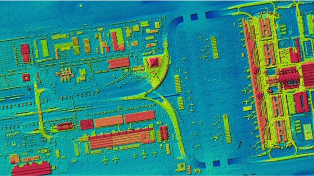
DIGITAL SURFACE MODELS (DSM)
Drone images can also be used to create DSM models of the area. Each pixel contains 2D information (X, Y) and the altitude (Z value) of the highest point for this position
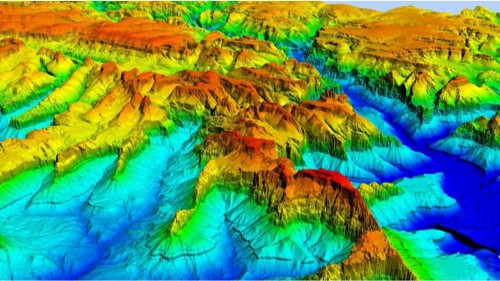
DIGITAL TERRAIN MODEL (DTM)
After filtering objects such as buildings, the drone images can be used to create DTMs with each pixel containing 2.5D information (X, Y, and Z value of the highest altitude)
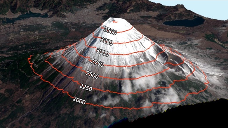
CONTOUR MAPS
Depending on the project requirements, either the DTM or DSM model, with custom contour intervals, can be used to create a contour lines map, giving you a better understanding of the surface of the area shot by the drone
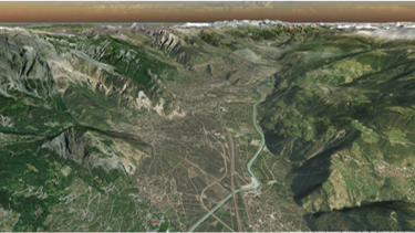
3D TEXTURED MESH
The 3D textured mesh is a reproduction of the edges, faces, vertices and texture of the area shot by the drone. This model is most useful for visual inspection or for when external stakeholders or public involvement is essential for a project
UAV Monitoring
Drones ensure the integrity and operational reliability of your assets through regular, detailed inspections, thereby supporting compliance with safety standards and preventive maintenance protocols
Asset And Facility Monitoring
Hybrid drone specializes in the inspection and monitoring of various assets and facilities, including but not limited to infrastructures and manufacturing plants
Disaster Management
Rapid, cost-effective mapping of disaster areas pinpoint damage hotspots for real-time aiding in situational awareness, damage assessment, and survivor search.
Industrial Inspection
UAVs cover large areas quickly and handle various applications, from security and surveillance to emergency response and infrastructure inspection in oil & gas facilities.
Solar PV Plant
UAVs carry out quicker, safer, accurate and cost effective inspection of a plant effortlessly, that helps run the plants at its peak efficiency uninterruptedly.
Wind Turbines
Drones equipped with appropriate cameras inspect and scan all rotor blades from all directions with lot of accuracy, speed and economy.
Power Transmission & Distribution Lines
Drone identifies all vulnerable and critical locations in the network including growth of vegetation, in no time.